
TL;DR: Entalula is the better beach for lounging, lunch and soft white sand framed by cliffs; Pinagbuyutan is the better pick for dramatic scenery and snorkeling around a towering limestone island — on most Tour B itineraries you visit both, so use this guide to decide where to spend your energy and your camera battery.
Tour B is often described as El Nido’s “underrated” island-hopping route, and two of its stops — Entalula Island and Pinagbuyutan Island — get confused constantly because they are both beach stops with limestone backdrops. This guide focuses on Entalula vs Pinagbuyutan specifically for travelers who are choosing between Tour B and another tour, booking a private boat with a custom route, or simply wanting to know where to snorkel and where to rest on the day. If you need the full route first, start with our complete Tour B guide.
- Quick Orientation: Where These Islands Sit
- Side-by-Side Comparison
- Entalula Island in Detail
- Pinagbuyutan Island in Detail
- Which One Should You Prioritize?
- A Sample Tour B Day Featuring Both Islands
- Common Mistakes to Avoid
- How Tour B Compares to Other Routes
- Timing, Seasons and Conditions
- Practical Tips for Both Stops
- Key Takeaways
- Frequently Asked Questions
Quick Orientation: Where These Islands Sit
Both islands lie in Bacuit Bay, the island-studded bay off El Nido town that falls within the El Nido-Taytay Managed Resource Protected Area. On a standard Tour B, boats typically combine Snake Island, Cudugnon Cave, Cathedral Cave, Entalula and Pinagbuyutan, though the exact order changes with tides, crowds and the boatman’s judgment.
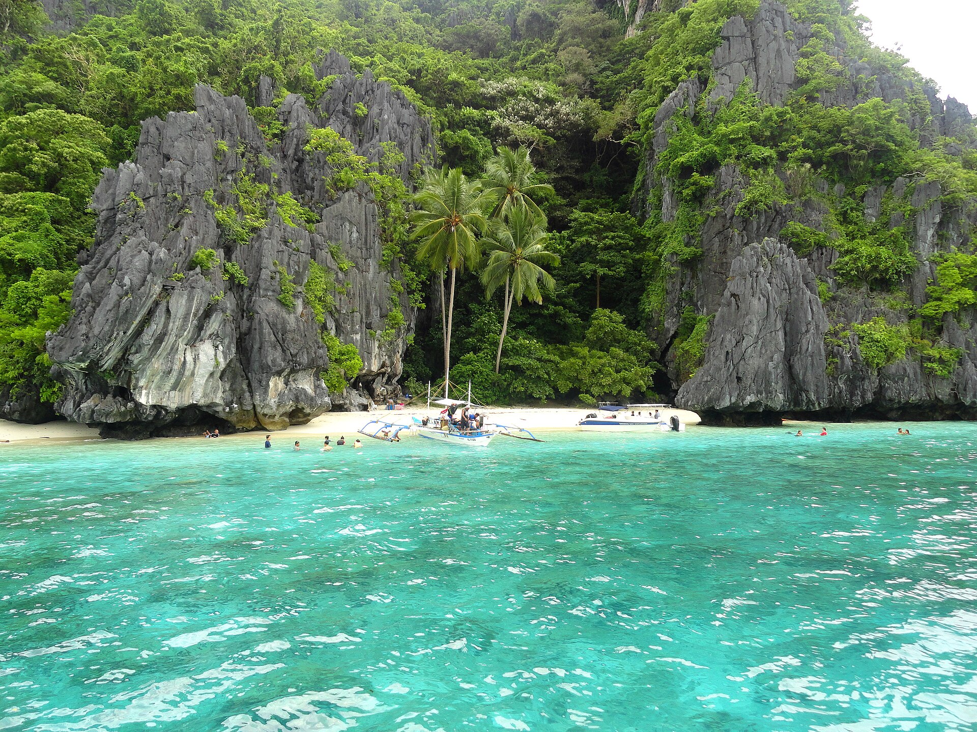
Pinagbuyutan is the instantly recognizable one: a steep, tower-like limestone island that you can see from many points around the bay, with a short strip of sand at its base. Entalula is lower and longer, with a curved white-sand beach set against cliffs and greenery. Both are reached in roughly 30 to 60 minutes by bangka from El Nido town depending on route and sea conditions.
Side-by-Side Comparison
| Factor | Entalula Island | Pinagbuyutan Island |
|---|---|---|
| Main appeal | Long, soft white-sand beach with cliff backdrop | Towering limestone island, dramatic silhouette |
| Beach size | Larger, room to spread out | Smaller strip at the base of cliffs |
| Snorkeling | Decent near rocks at the ends of the beach | Often better; coral and fish around the island’s edges |
| Photography | Classic beach shots, palm-and-cliff compositions | Iconic wide shots of the island from the boat |
| Common role on Tour B | Frequent lunch or long swim stop | Swim and snorkel stop, sometimes lunch |
| Crowds | Busier at lunchtime | Varies; quieter outside the lunch rush |
| Best for | Families, relaxing, sunbathing | Snorkelers, photographers |
Entalula Island in Detail
Entalula is the stop where most Tour B groups slow down. The beach is long enough that even when several boats pull in, you can usually walk to a quieter section. The sand is fine and pale, and the water in front of the beach is typically calm in the dry season, which makes it one of the easier swimming spots on the route for children and less confident swimmers.
Many operators set up the lunch buffet here — grilled fish, pork or chicken, rice, vegetables and fresh fruit — so Entalula is also where you will spend the longest time ashore. Use that time well: walk to the rocky ends of the beach to snorkel, find shade under the trees during the midday heat, and save the beach photos for when the lunch crowd thins out. Our dedicated Entalula Beach guide has more on facilities and timing.
Watch out for: strong midday sun with limited shade at the waterline, sharp rocks at the beach ends, and occasional jellyfish in certain months. Water shoes help.
Pinagbuyutan Island in Detail
Pinagbuyutan is the stop people photograph from the boat before they even land. The island rises steeply out of the water, and its silhouette is one of the most distinctive shapes in Bacuit Bay. The beach at its base is smaller than Entalula’s, and part of the island is privately managed, so landing arrangements can change — your boatman will know the current rules.
Where Pinagbuyutan shines is in the water. The reef around its edges often has healthier coral and more fish than the busier beach stops, especially if you swim a little way from where the boats anchor. Visibility depends heavily on season and weather; see the timing notes below and our main Pinagbuyutan Island guide.
Watch out for: currents along the island’s edges, boat traffic near the anchoring area, and fragile coral in shallow sections. Never stand on coral, and keep fins up when you are in shallow water.
Which One Should You Prioritize?
On a standard group Tour B you will usually visit both, so the question is really how to use your time:
- If you love snorkeling: spend your energy at Pinagbuyutan. Get in the water quickly when you arrive, and swim along the edges rather than staying near the boats.
- If you want to relax: treat Entalula as your beach break. Eat, rest in the shade and swim in calm water.
- If you are a photographer: shoot Pinagbuyutan from the boat during the approach (ask the boatman for a slow pass), and shoot Entalula’s beach after the lunch crowd leaves.
- If you are traveling with kids: Entalula’s larger, gentler beach is easier to manage.
If you are booking a private boat, you can ask for a longer stop at whichever island suits you. Private tours also let you avoid the peak lunch hour at Entalula by eating earlier or later.
A Sample Tour B Day Featuring Both Islands
Every operator runs Tour B a little differently, but a common pattern looks like this. Boats leave El Nido town beach around 9:00 a.m. after the environmental fee check. The first stops are often the caves — Cudugnon and Cathedral — while the light is still soft and before the water gets choppy. By late morning the boat heads to Pinagbuyutan for a swim and snorkel; this is when you want to get in the water quickly, before other boats arrive. Around midday, the crew moves to Entalula and sets up lunch on the beach, giving you one to one-and-a-half hours to eat, swim and rest in the shade. The afternoon usually finishes at Snake Island, where the sandbar is most impressive at lower tide, before returning to town between 4:00 and 5:00 p.m. If your boatman reverses the order, the advice stays the same: snorkel hard at Pinagbuyutan, relax at Entalula.
Common Mistakes to Avoid
Travelers often spend all their time at Entalula photographing the lunch spread and then skip the water entirely at Pinagbuyutan because they are tired — that is backwards if you care about marine life. Others forget that the approach to Pinagbuyutan is the best photo angle and have their phone packed away in a dry bag at the critical moment. Some assume they can swim from one island to another, which is unsafe because of boat traffic and currents. Finally, do not leave your environmental fee tag at your hotel; rangers may ask to see it during the day.
How Tour B Compares to Other Routes
Tour B trades the famous lagoons of Tour A for caves, beaches and a quieter rhythm. Travelers who have only one day usually choose Tour A, while those with two or more days often add Tour B or a combination. Our Tour A vs Tour B comparison and Tour B vs Tour D comparison break down the trade-offs. If caves are your thing, read about Cudugnon Cave as well — it is on the same route.
Timing, Seasons and Conditions
From about November to May, Bacuit Bay is generally calmer and Tour B runs on most days. During the southwest monsoon season (habagat), roughly June to October, the bay can be rough, and tours may be cancelled or rerouted on short notice by the local authorities. If you are traveling in these months, keep spare days in your itinerary and check the latest bulletins from PAGASA.
Tides matter too. At low tide some landings involve more wading, and snorkeling in shallow sections becomes riskier for the coral. At high tide, beaches are narrower. The El Nido tide times guide explains how to read the tables.
Practical Tips for Both Stops
- Bring your own snorkel mask if you can; rental masks often leak or fog.
- Carry reef-safe sunscreen and a rash guard to reduce how much sunscreen goes into the water.
- Pay your environmental fee in advance — your operator will usually handle it and give you a tag or receipt to keep.
- Keep valuables in a dry bag on the boat; beaches have no lockers.
- Take your trash back to town. Both islands are within a protected area.
- Ask about the day’s order of stops so you know which island comes first.
Key Takeaways
- Entalula is the best Tour B stop for relaxing, lunch and family-friendly swimming.
- Pinagbuyutan is the most dramatic island visually and usually the better snorkel stop.
- Most group Tour B itineraries include both, with the order set on the day.
- Photograph Pinagbuyutan from the boat; shoot Entalula’s beach after the lunch rush.
- Private boats let you lengthen the stop you care about and dodge peak crowds.
- Plan Tour B for November to May; keep backup days in habagat season.
Frequently Asked Questions
Are Entalula and Pinagbuyutan both on Tour B?
Yes. Standard El Nido Tour B itineraries commonly include both islands, along with Snake Island, Cudugnon Cave and Cathedral Cave.
Which island has better snorkeling?
Pinagbuyutan usually offers better snorkeling around the edges of the island, though conditions vary by season and weather.
Where is lunch served on Tour B?
Operators often serve lunch at Entalula, but some use Pinagbuyutan or another beach depending on crowds and tides.
Can I visit Entalula or Pinagbuyutan on a private tour?
Yes. Private boats can include either island and let you choose how long to stay, subject to local rules and fees.
Is there an extra fee for these islands?
The standard environmental fee covers protected-area visits; additional fees can apply at some privately managed sites, so ask your operator.
About the Author
This guide was compiled by the El Nido Hotels Ranking editorial team, with input from local operators and ongoing on-the-ground updates.